Roman bridge over the Guadiana
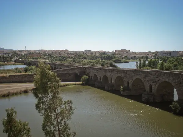
The Roman bridge over the river Guadiana, at Augusta Emerita (Mérida), reckoned the longest surviving bridge of antiquity. Its construction is tied to the founding of the colony in 25 BC, under Augustus, and it was the piece that made sense of where the city was put: through it came and went the roads that made Emerita the capital of Lusitania and one of the great road junctions of the western peninsula — among them the Iter ab Emerita Olisiponem, towards Lisbon, and the road north now known as the Vía de la Plata.
- Type
- Bridge
- Preservation
- Standing
- Protection
- Listed · RI-51-0000110
- Listed
- 13/12/1912
- Coordinates
- 38.91306, -6.35083
- Photographs
- 18
What it is and what is left
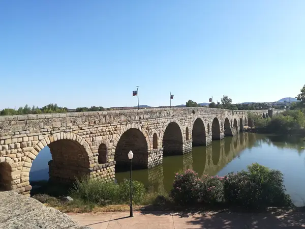
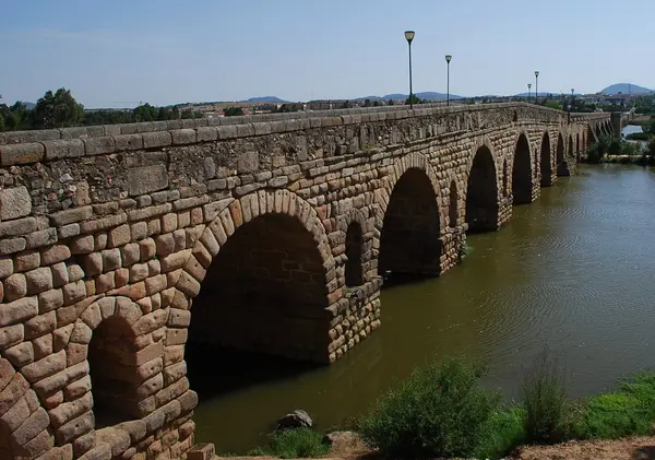
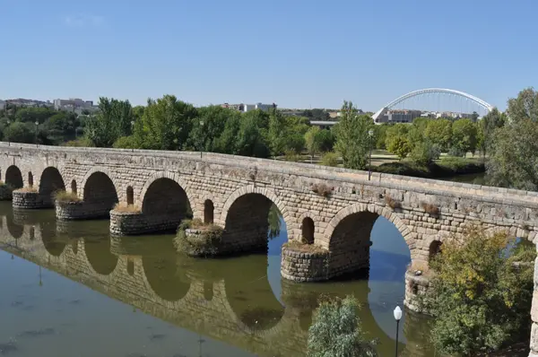
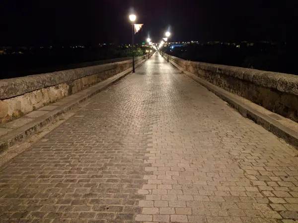
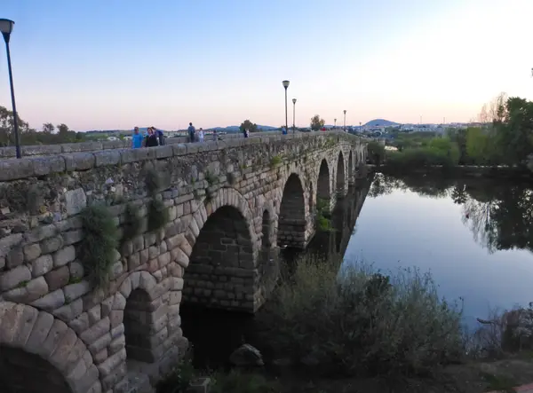
It is some 790-792 m long, around 7.1 m wide and about 12 m above the water, carried on sixty arches, three of them rediscovered in the late 1990s. Originally it crossed the river in two stretches separated by a central cutwater that made use of a river island. It is built with a core of opus caementicium faced with rusticated granite ashlar, with relief openings between the arches to let water through in flood, and rounded cutwaters upstream.
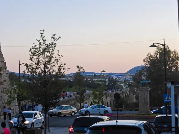
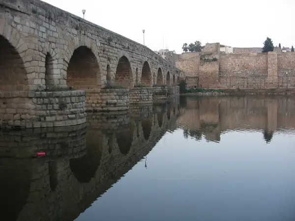
It is a palimpsest: more than two thousand years of floods and conflict have forced repeated rebuilding, and the original features are recognisable mainly in the approach stretches. Its strategic importance explains why the Alcazaba was raised at its head in 835, to control the crossing; work in the last third of the 19th century gave it the look it has today. It carried motor traffic until the early 1990s, when the opening of the Lusitania bridge allowed it to be left to pedestrians alone.
Declared a national monument in 1912 and listed (RI-51-0000110), it is part of the Archaeological Ensemble of Mérida, a UNESCO World Heritage site since 1993.
What each period left here
It reads downwards: each band is a period with fabric in this site, newest first, deepest last.
2 facts
0 photographs
Early modern
This site has fabric from this period. Mérida has 8 more sites built in the same layer.
See the whole layer →Several of its arches were not taken by a flood: they were blown up during the Peninsular War (1808-1814) to stop Napoleon's troops crossing.
Puente romano de Mérida — WikipediaThe floods of the Guadiana have marked its history with dates and names: the one in 1603 did enormous damage, there was another in 1823, and the damage of 1860 was not repaired until 1878.
Puente romano de Mérida — Wikipedia0 facts
0 photographs
Christian medieval
This site has fabric from this period. Mérida has 8 more sites built in the same layer.
See the whole layer →0 facts
0 photographs
Roman
This site has fabric from this period. Mérida has 57 more sites built in the same layer.
See the whole layer →Below the deepest layer of each site is the ground itself: what has not been excavated yet, or what left nothing built. The catalogue only claims what is documented.
What is told about this site
It has sixty arches, but three of them were buried and unseen until the late 1990s, when work to restore the banks of the Guadiana brought them to light.
Puente romano de Mérida — WikipediaThe river splits in two around an island, and the Romans protected the middle stretch with a cutwater running 150 m upstream, to break the current before it reached the piers.
Puente romano de Mérida — WikipediaIt carried motor traffic until 10 December 1991: that day the Lusitania bridge opened and the Roman one was left to pedestrians, after close to two thousand years of use.
Puente romano de Mérida — WikipediaPhotographs
A short walk from here
Straight-line distances, worked out from the coordinates of each site.
Where this page comes from
- Puente romano sobre el Guadiana — Consorcio Ciudad Monumental de Mérida consorciomerida.org